Archive for February 2018
Jan 2018 Norquay Listings
The following offers to sell properties in Norquay were found on Multiple Listing Service at some point during the month of January 2018. This data is collected as part of Eye on Norquay’s efforts to monitor the affordable new housing types that the Norquay Plan intended to spread across our local area. Other periods, in sequence, can be viewed with a click on the Price Data category link.
Single Family House
Address Ask Price Lot (ft) Sq Ft Year Zone
2220 E 30th Ave $2,992,462 33 x 125 2267 1998 RM-9A
2324 E 30th Ave $1,888,000 32 x 115 1700 1956 RM-9A
Assembly:
2366 E 33rd Ave $2,200,000 33 x 115 RM-7
2374 E 33rd Ave $2,200,000 33 x 115 RM-7
2380 E 33rd Ave $2,200,000 33 x 115 RM-9A
2495 E 34th Ave $1,898,000 31 x 114 2000 2011 RM-7
2481 E 40th Ave $2,050,000 33 x 140 2776 1977 RT-11
4665 Baldwin St $1,928,000 62 x 118 2705 1967 RT-11
Assembly:
4863 Baldwin St $1,650,000 33 x 93 1856 1980 RM-9A
4873 Baldwin St $1,650,000 33 x 93 1420 1955 RM-9A
4885 Baldwin St $1,650,000 33 x 93 1858 1980 RM-9A
Assembly:
5005 Chambers St $2,939,000 52 x 104 1986 RM-7
5021 Chambers St $2,049,000 34 x 104 1400 RM-7
2826 Cheyenne Ave $1,718,000 29 x 106 1940 1958 RM-7
$1,680,000
Assembly:
2681 Duke St $2,398,000 33 x 102 1995 2013 RM-7
2683 Duke St $1,599,000 33 x 102 RM-7
2689 Duke St $1,599,000 33 x 102 RM-7
2751 Duke St $1,928,000 33 x 102 2005 2015 RM-7
Price change: $1,888,000
5511 Dundee St $1,688,000 32 x 105 2015 2002 RT-11
4925 Earles St $2,500,000 33 x 110 2178 1992 RM-7
5559 Earles St $2,099,000 46 x 119 2490 2005 RT-11
2840 Euclid Ave $2,980,000 50 x 122 2250 1964 RM-7
Assembly:
4718 Gladstone St $2,994,559 4140 sq ft 2162 1997 RM-9
4736 Gladstone St $2,842,876 33 x 119 2116 1996 RM-9
4748 Gladstone St $2,868,040 33 x 120 2132 1997 RM-9
5009 Killarney St $1,550,000 33 x 98 2100 1993 RT-11
5207 Killarney St $1,550,000 33 x 105 1864 2002 RT-11
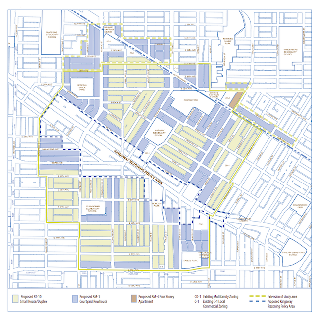
2315 Kingsway $3,500,000 33 x 105 2000 1970 KRPA
4866 Moss St $1,698,000 33 x 99 2420 2016 RT-11
5033 Moss St $1,295,000 33 x 99 2231 1949 RT-11
Assembly:
5264 Rhodes St $3,500,000 32 x 157 3149 1987 RM-9A
5296 Rhodes St $3,500,000 32 x 166 3250 1980 RM-9A
5525 Rhodes St $1,795,000 33 x 126 2341 1984 RT-11
4657 Slocan St $1,649,000 33 x 110 2670 1947 RM-7
Assembly:
5109 Slocan St $2,388,000 34 x 104 1980 1982 RM-7
5125 Slocan St $2,388,000 34 x 104 2040 1980 RM-7
5139 Slocan St $2,388,000 34 x 104 1407 RM-7
2632 Ward St $1,800,000 33 x 102 2040 1955 RM-7
2703 Ward St $1,518,000 33 x 102 2100 RM-7
2775 Ward St $1,640,000 33 x 102 1700 1932 RM-7
* KRPA = Kingsway Rezoning Policy Area
Duplex
Address                      Ask Price     Sq Ft      Year     Zone

2308 E 33rd Ave             $1,388,000      1587      2018     RM-7

5474 Dundee St              $1,568,000      2036      2018     RT-11

5476 Dundee St              $1,548,000      2036      2018     RT-11

5485 Dundee St              $1,250,000      1309      2017     RT-11
Price change:               $1,198,000

5487 Dundee St              $1,250,000      1309      2017     RT-11
Price change:               $1,198,000

2156A Mannering Ave         $1,199,000      1424      2017     RT-11

2156B Mannering Ave         $1,199,000      1424      2017     RT-11

2210 Mannering Ave          $1,250,000      1446      2017     RT-11

2212 Mannering Ave          $1,250,000      1446      2017     RT-11

5150 Nanaimo St             $1,388,000      1356      2017     RM-7
Small House
(strata title in RT-11 zone)
Address                      Ask Price     Sq Ft      Year

2355 E 41st Ave             $1,088,000      1548      2016

5653 Killarney St           $1,188,000      1226      2017

5659 Killarney St           $1,188,000      1424      2017

5663 Killarney St           $  988,000      1159      2017

Pre-construction:
2680 Norquay St             $  699,000       720      2018
2688 Norquay St             $  999,900      1169      2018
Rowhouse / Stacked Townhouse
(strata title in RM-7 zone)
Address                      Ask Price     Sq Ft      Year

5186 Chambers St            $  598,800       649      2017

5198 Chambers St            $  859,000       841      2017
Apartment
(strata title in CD-1 zonings)
Address                      Ask Price     Sq Ft      Year

101-4893 Clarendon St         $499,000       893      1995

208-4893 Clarendon St         $498,000       896      1995

307-2965 Horley St            $579,000       867      1994

225-2239 Kingsway             $699,800       881      2011
2220 Kingsway
The listings below are for Kensington Gardens, the Westbank project
with 400+ units under construction, with completion projected for
2018
Address                       Ask Price    Sq Ft

102-2220 Kingsway            $1,939,000     1023

103-2220 Kingsway              $988,000     1018

308-2220 Kingsway              $699,000      790

326-2220 Kingsway              $759,999      883

511-2220 Kingsway              $768,000      894

517-2220 Kingsway              $510,000      512

518-2220 Kingsway              $495,000      529

608-2220 Kingsway              $739,900      790

806-2220 Kingsway              $720,000      798

906-2220 Kingsway              $954,000     1072

1002-2220 Kingsway             $739,000      738

1009-2220 Kingsway             $488,000      551

1012-2220 Kingsway             $768,000      812

1108-2220 Kingsway           $1,080,000      992

1206-2220 Kingsway           $1,068,888     1060

1211-2220 Kingsway             $788,000      717

1501-2220 Kingsway             $488,000      517

1508-2220 Kingsway             $749,000      720

1511-2220 Kingsway             $680,000      717

1605-2220 Kingsway           $1,088,800      980

1706-2220 Kingsway           $1,089,000     1060

1708-2229 Kingsway             $788,000      720

1808-2220 Kingsway           $1,049,000      789

NE615-2220 Kingsway            $698,900      733

NE702-2220 Kingsway            $859,900     1139

NE811-2220 Kingsway            $726,000      812

NE1502-2220 Kingsway           $830,000      896

NE1611-2220 Kingsway           $708,000      717

NE PH6-2220 Kingsway           $884,900      807

S1008-2220 Kingsway            $928,900      992

W605-2220 Kingsway             $469,800      510

W1510-2220 Kingsway            $699,000      777

W1606-2220 Kingsway            $550,000      505

W PH1-2220 Kingsway            $828,000      755
Station Area Planning History
A History of Planning in the Nanaimo / 29th Avenue Station Areas
February 2018
In November 2017, Vancouver City Council approved Housing Vancouver Strategy (2018-2027) and 3-Year Action Plan (2018-2020). (Find multiple links to report, appendixes, staff presentation, video clip at http://council.vancouver.ca/20171128/regu20171128ag.htm )
According to this document, a major planning program for the Nanaimo and 29th Avenue station areas will begin in 2018. Land around these stations will be rezoned “to create more affordable housing and deliver large increases in rental, social, and ground-oriented market housing.” (p. 10) Appendix B page 7 lists as “Key Strategy 1-B” to “launch” these new station area plans immediately after Council approval of the policy document.
Eye on Norquay sees a need to provide background context for this imminent planning program. Past planning processes for the Nanaimo / 29th Station Areas are described below.
1. Nanaimo / 29th Avenue Station Areas Plan (1987)
Summary document only online at:
http://guidelines.vancouver.ca/N003.pdf
In 1981 the Government of British Columbia announced the selection of the Advanced Light Rapid Transit (ALRT) system for Greater Vancouver. Soon after, the City of Vancouver began to plan for the lands immediately around the four SkyTrain stations proposed for East Vancouver: Broadway, Nanaimo, 29th Avenue, and Joyce. Separate plans were developed for the Broadway and Joyce Station Areas.
A single plan was proposed for the Nanaimo and 29th Avenue Station Areas. No reason is apparent in available city documents for the combining of planning for these two stations into a single program. The life expectancy of a plan is often set at 25—30 years. The provisions of this plan are no longer referenced in City of Vancouver planning documents.
Plan Summary
Properties between Victoria Drive and Rupert Street, and between Kingsway and roughly East 22nd Avenue, are included in this plan. The northern boundary zigzags because the ALRT line runs parallel to Kingsway, which cuts across the street grid.

Most of the Plan consists of a detailed analysis of 21 potential development sites. The sites were selected because they met at least one of these criteria:
• Vacant city-owned sites
• Sites severely impacted by ALRT
• Sites soned for uses other than residential
• Sites either under-utilized or containing derelict properties
Redevelopment opportunities were to be limited to these 21 sites. (See Appendix A for details of implementation.)
The 21 selected sites are identified by the letters on the map below. Sites that were City-owned in 1987 are Sites A, C (partial), D, E, G (partial), J, K, L, and N (partial), In cases where the City owns only a part of the identified site, no redevelopment is specified to occur until adjoining private land has been purchased and incorporated into the site.

The Plan recommends multi-family townhouses (described as “medium density”) as the form of development most viable and appropriate for the majority of the identified sites. Unit density is set at 25-40 units per acre and maximum FSR is set at 1.0. The proposed developments are to act as a noise and visual buffer between the SkyTrain alignment and the existing single-family residences to the north and south.
Commercial redevelopment is to be small-scale and serve local needs only. It is not to negatively impact Kingsway, which is to remain the primary commercial area.
Considerable analysis of ALRT impacts is included in the Plan. Unresolved impacts identified in 1987 are primarily related to noise, privacy loss and visual intrusion.
The amenity most desired by the community in 1987 was an indoor swimming pool. However, Council rejected this request on the advice of the Park Board. Staff believed that residents already had sufficient access to swimming pools in nearby neighbourhoods.
In 1987 Vancouver had no shortage of sites for development. The population was expected to grow slowly and the economy was recovering from a recession. Redevelopment of the Nanaimo / 29th Avenue Station Areas was expected to be gradual and low key.
2. Renfrew-Collingwood Community Vision (2004)
http://former.vancouver.ca/commsvcs/planning/cityplan/Visions/rc/vision.htm
CityPlan (1995) was the City’s policy framework to direct future Vancouver city planning, especially in residential neighbourhoods that had not previously experienced detailed planning initiatives. Nine neighbourhoods, including Renfrew-Collingwood, went through extensive visioning processes that were directed by City staff but included substantial community input.
The resulting Renfrew-Collingwood Community Vision looked at locations for future low-rise housing forms (primarily townhouses and 4-storey apartment buldings). The relevant direction for the Nanaimo and 29th Avenue Station Areas reads:
New housing types should be permitted in existing residential areas around the Nanaimo and
29th Avenue SkyTrain stations, subject to detailed planning and impact mitigation. (p. 42)
This direction received more than 50% agreement in a community survey, but fell short of the support it needed to be classified as “approved.” It was classified as “uncertain,” which means that it will “remain on the table for future community discussion in subsequent planning processes.” (p. 6)
3. The Norquay Village Neighbourhood Centre Draft Plan (2007) [rejected]
http://former.vancouver.ca/commsvcs/planning/neighcentres/norquay/pdf/newsletter3english.pdf
The Norquay Village Neighbourhood Centre planning process began in 2006. The area to be included was originally defined as the area near Kingsway between Nanaimo Street and Earles Street. Boundaries were extended during the planning process to include most of those areas that had been identified as “development opportunities” in the earlier Nanaimo and 29th Avenue Station Areas Plan (1987) as well as additional lands further from the SkyTrain alignment. Residents rejected the draft plan (map shown below) via a community survey in 2007. (That was the last formal community survey that City of Vancouver ever undertook.)
4. The Norquay Village Neighbourhood Centre Plan (2010)
http://council.vancouver.ca/20101104/documents/penv2.pdf
A second phase of Norquay planning 2008-2009 failed to produce a plan. When a third planning phase was launched in November 2009, the areas near the SkyTrain alignment were removed from consideration. The map below shows the final boundaries of the Norquay Village Neighbourhood Centre as well as the areas near the SkyTrain that were excluded from the planning process at that time.

The two station areas were designated for a future station area planning process. The relevant board from a community open house on 30 January 2010 is reproduced below.

Slocan Park is located in the area that was removed from the planning process, but the park serves a large area of Norquay. A direction was included in the Plan to incorporate additional land into the park to provide an enhanced street presence. (p. 71)
5. Norquay Village Public Benefits Strategy (2013) and
Norquay Village Public Realm Plan (April 2016)
http://vancouver.ca/files/cov/norquay-village-public-benefits-strategy.pdf
and
http://vancouver.ca/files/cov/norquay-village-public-realm-plan.pdf
These later documents reiterate the need to upgrade Slocan Park. The park is included in the listing of Norquay’s parks to be renewed “over time and as the surrounding population and park usage increase.” (Norquay Village Public Realm Plan, p. 8)
Appendix A: Redevelopment under the 1987 Nanaimo and 29th Station Areas Plan
The twenty-one sites identified in the 1987 Plan as potential sites for redevelopment were subsequently rezoned to CD-1 (Comprehensive Development).
Many of the sites identified as suitable for multi-family residential development have not yet been redeveloped as planned. No redevelopment has occurred on adjoining Sites B and C, a fairly large area that includes the Copley Community Orchard. A few parcels have been redeveloped with single-family houses within Sites F, N, and O. Within sites M, R and S, small-scale redevelopment has taken place in the form of duplexes or triplexes on a few individual lots.
In October 2015 a policy document titled “Parking Amendments to Various DC-1 By-laws for Sites Adjacent to SkyTrain was approved by City Council. This policy reduced parking requirements on identified sites that had not yet been completely redeveloped (i.e. sites B, C, F, G, M, N, O, Q and S). The reason given for reducing the parking requirement from 1-2 per unit to 0.65 per unit is the proximity of the sites to SkyTrain stations. City staff argued that excessive parking requirements were hindering redevelopment of these sites.
Sites that have been completely or partially redeveloped as multi-family housing include:
Site G: The Nanaimo SkyTrain Station and bus loop covers the northern corner of this site. The Westridge (4170/4180 Nanaimo Street), a complex of two 4-storey affordable rental apartment buildings, has been built along the Nanaimo frontage. The 10 parcels with single-family houses along E. 26th Avenue have not been yet been incorporated into the site. The City-owned land east of the apartment building, where a steel foundry was located in the past, is likely contaminated and remains vacant.
Site H: Chelsea Green (4120 Kamloops), a 29-unit “family townhouse” development with rents set at 30% of income, was built on this site in 1989.
Site N: Until now the City-owned part of this site east of Kaslo Street has been in use as a community garden. A development application is in process to build a 52-unit Temporary Modular Housing development at this location. The community garden will be moved to Slocan Park.
Site P: Heritage Gate (2960 East 29th Avenue), a 56-unit strata described on management’s web site as a “townhouse style apartment complex,” was built on this site in 1990.
Site Q: A 3-unit traditional rowhouse development is currently under construction at 4521 Earles Street.
In advance of expected station area planning, two sites have been assembled recently:
Site F: Has been assembled and sold.
Site O: Has been partially assembled, but to our knowledge no land has yet been sold.
A few small sites have been developed for uses other than housing, as recommended by the Plan.
Site E: Three of the four lots on the northwest corner of Brant Street and E. 25th Avenue have been incorporated into the Learning Tree Daycare Centre. One lot was considered surplus to their needs and has presumably been sold.
Site J: This small site functions as a pocket park.
Sites K and L: These sites are now a part of the B.C. Parkway system, to be maintained by the B.C. Parkway Society. Site K on the south side of the alignment is named the Penticton Children’s Park. However, all of the play equipment originally installed in the park has been removed and not replaced.
Sites A and D were reserved by the Plan for future development opportunities. Site D is currently being used as a community garden.
Some redevelopment has taken place on unidentified sites adjacent to the SkyTrain alignment. These include:
The Beacon (4320 Slocan Street): A 4-storey, 41 unit affordable rental building with ground-level retail was completed in 2017 under the Rental 100 policy.
Earles Court (4590 Earles Street): A former B.C. Electric Substation was converted into 12 apartment condo units in 1990.
3560-3570 Hull Street & 2070-2090 East 20th Avenue: A rezoning application is currently in process to rezone this site to CD-1 to permit a 3.5 storey development of 41 townhouses, a 28-unit apartment building, and a heritage house under the Affordable Housing Choices Interim Rezoning Policy.

4410 Kaslo St TMH
leave a comment »
Comment on Development Application DP-2018-00024
4410 Kaslo Street – Temporary Modular Housing
http://development.vancouver.ca/4410kaslo/index.htm
13 February 2017
In general, we support the design of this project. We commend the larger units, the outdoor amenity space, and the commercial kitchen and common dining area. We also commend the small lounge area on the ground floor.
We recommend the following changes to the design:
1. Reverse the positions of the entrance/vestibule/lobby area and the office/meeting room area on the ground floor near the front entrance. As drawn, the sight line from the front entrance is toward staff space rather than toward common space for the residents. As configured at present, residents would feel that they are being housed in an institution rather than in a home of their own. The placement of the front entrance (with the attached vestibule and lobby) should be shifted so that the sight line when entering the building is toward the common dining area and lounge.
2. Separate the two dining areas by a half wall rather than a full wall to make the dining area seem like a single space and to allow more natural light. (This may already be the intention.) In addition we call attention to this discrepancy: the larger dining area is described as seating 36, but the drawing shows seating for only 32.
3. Provide a small lounge area and laundry on each floor. A single ground-floor lounge that seats 8 people seems inadequate for a building with 52 residents. Although convenient to the dining area, that one common area is located far from the rooms of many residents. A small lounge on each floor would provide additional space and would foster social interaction. If a single unit on each of the second and third floors were converted to space for a small lounge and a laundry facility, the total unit count would return to the originally proposed 50 units.
Jeanette and Joseph Jones
Written by eyeonnorquay
15 February 2018 at 10:31 am
Posted in Comments, Kaslo TMH, Temp Modular Housing